Landslide risk management increasingly relies on continuous, reliable and interpretable monitoring data to move from reactive response to proactive control.
At Sixense, we design and deploy integrated landslide monitoring systems that combine in-situ instrumentation, remote sensing and environmental data to provide a comprehensive understanding of slope behaviour.
The illustration below presents options for a typical monitoring system for landslide affected areas, integrating:
🧭 Surface movement tracking
• GNSS and total station monitoring of slopes and assets
• Crack monitoring on pavements, retaining walls and rock faces
🌍 Sub-surface deformation and hydrogeology
• Inclinometers to identify active slip surfaces
• Piezometers to monitor groundwater response to rainfall events
📡 Remote sensing and trigger analysis
• Satellite InSAR for regional deformation screening
• Weather and rainfall data to assess triggering thresholds
When combined within our Beyond Monitoring platform, these data enable:
• Early detection of instability trends
• Improved understanding of triggering mechanisms
• Better informed operational and mitigation decisions
• Transparent reporting for asset owners and regulators
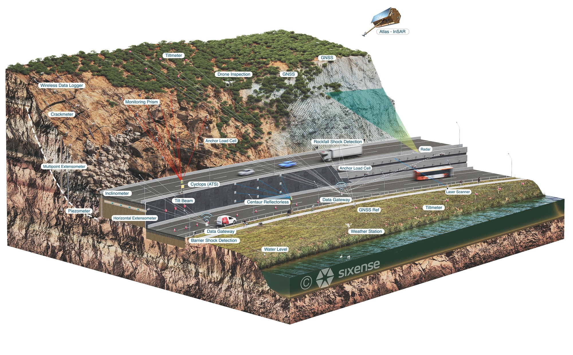
Image: Sixense monitoring solutions for landslides